


Walks on Jeju Island _Jeju Olle

Tsung
2 months ago
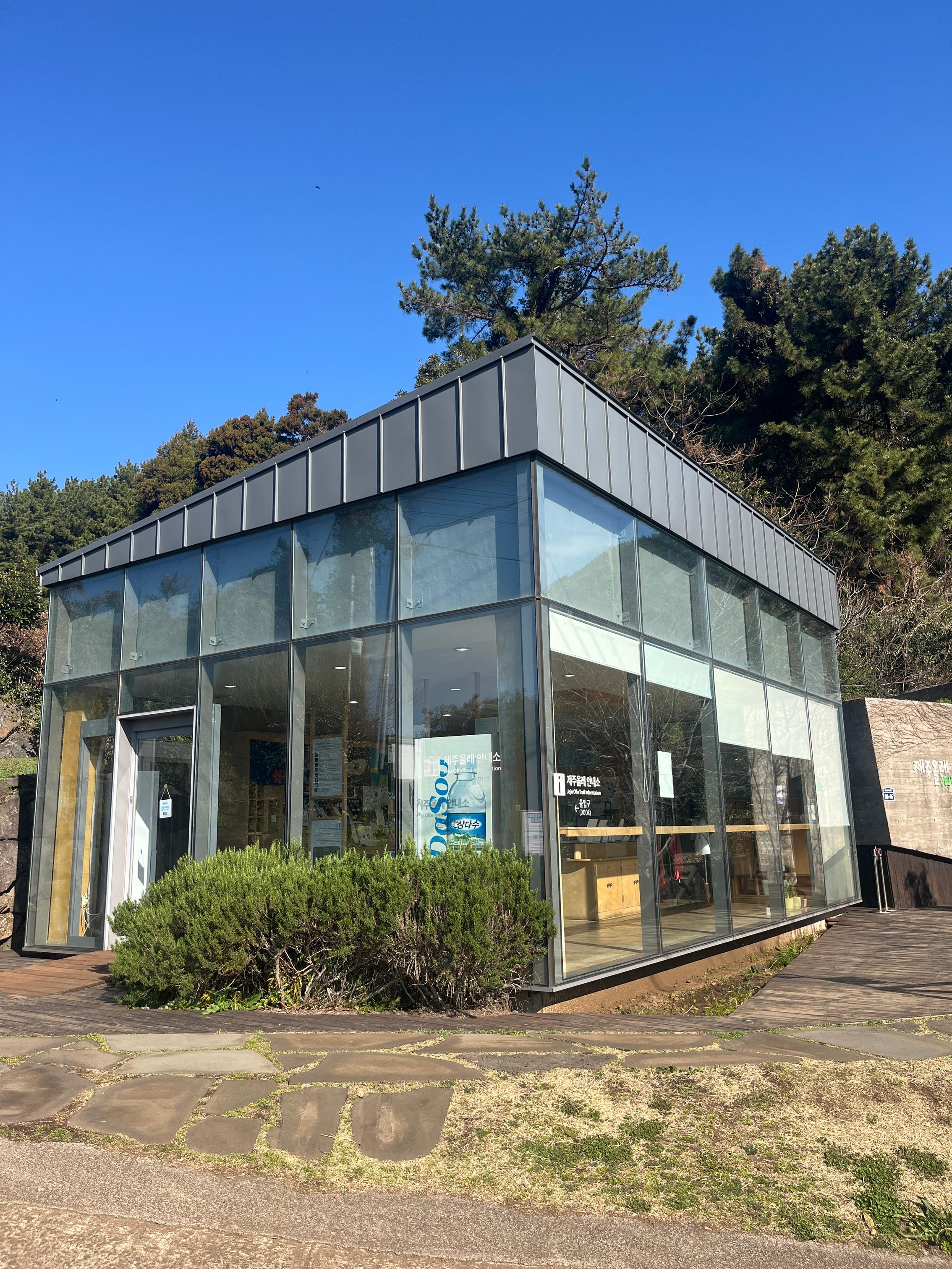
This time I came to Jeju Island specifically to hike Jeju Olle, with the goal of completing the hiking certifications for the Kumano Kodo, Camino de Santiago, and the Olle Trails within one year. Honestly, Kumano Kodo felt the toughest, there’s a lot more time spent climbing. Along the Camino de Santiago you see churches everywhere and pass through towns of all sizes, each with its own character. But in terms of travel costs and overall value, the Olle Trails are a really good choice. The route variety is huge, I think it’s an excellent hiking option. Also, every few stamp points has a small visitor center that provides information for hikers, which I felt was really thoughtful.
Hiking in March this time was a bit chilly, mornings and evenings were around the low teens, but for walking it felt very comfortable, you don’t end up sweaty and sticky. I hope I’ll get the chance to bring my wife and two daughters to hike Jeju Olle too, and help them complete the dual certification (they’ve also already completed Camino de Santiago).
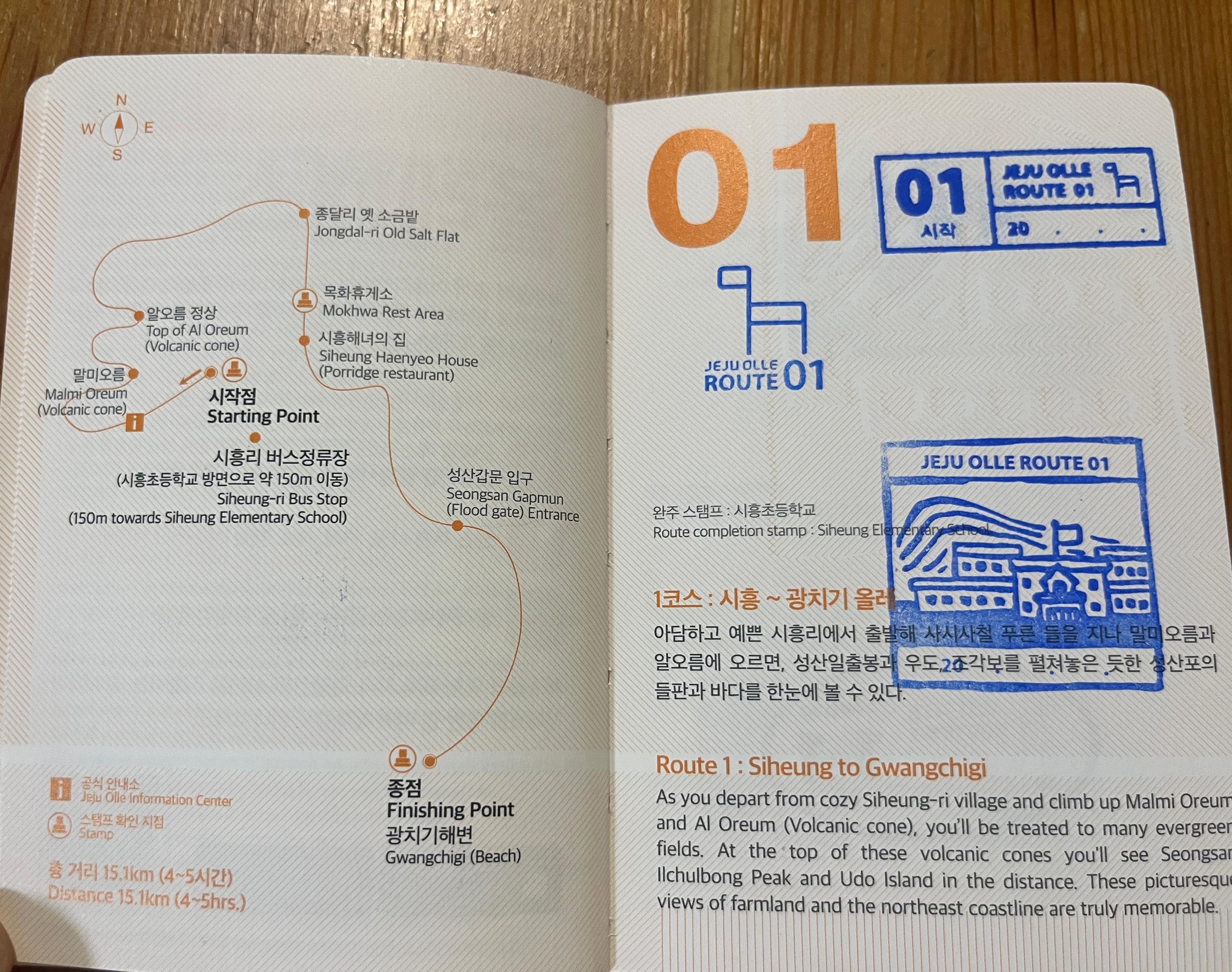
For this trip, I started from Trail 1 and continued in order. As soon as I landed early in the morning, I took the bus straight to the Trail 1 visitor center. The Olle Trail stamp passport sells for 20,000 Korean won, which is about TWD 450, honestly a bit pricey, but it supports the maintenance and operation of the whole trail system. There are two designs, a blue booklet representing the sea of Jeju Island, also said to represent walking clockwise, and an orange one representing the citrus Jeju Seogwipo is famous for, also said to represent walking counterclockwise. I didn’t overthink it and chose orange.
A small tip, after you land, it’s better to rest in the city for a day before starting. Don’t be like me, taking a red-eye flight with barely any sleep, then starting to walk first thing in the morning, it was brutal.
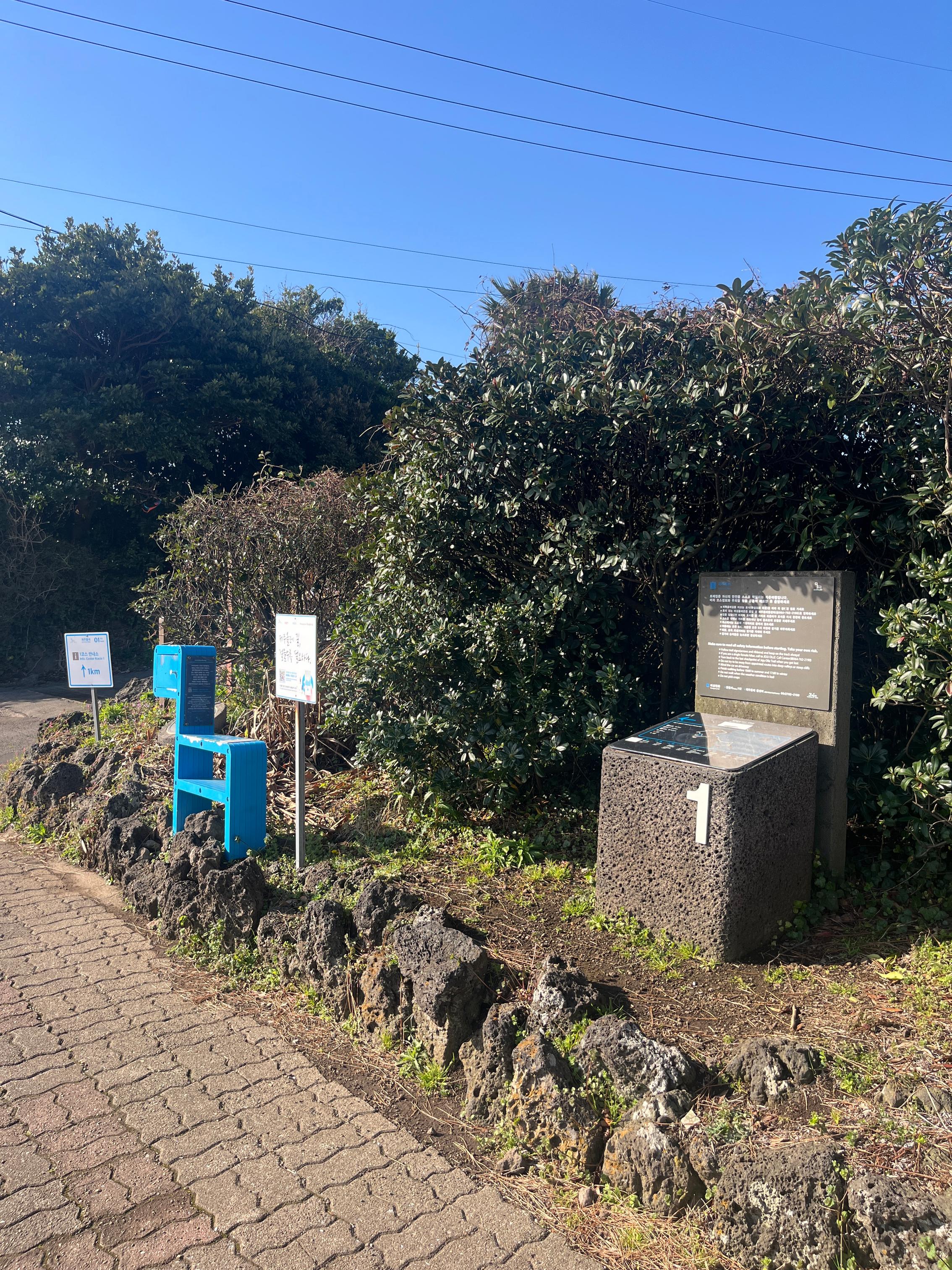
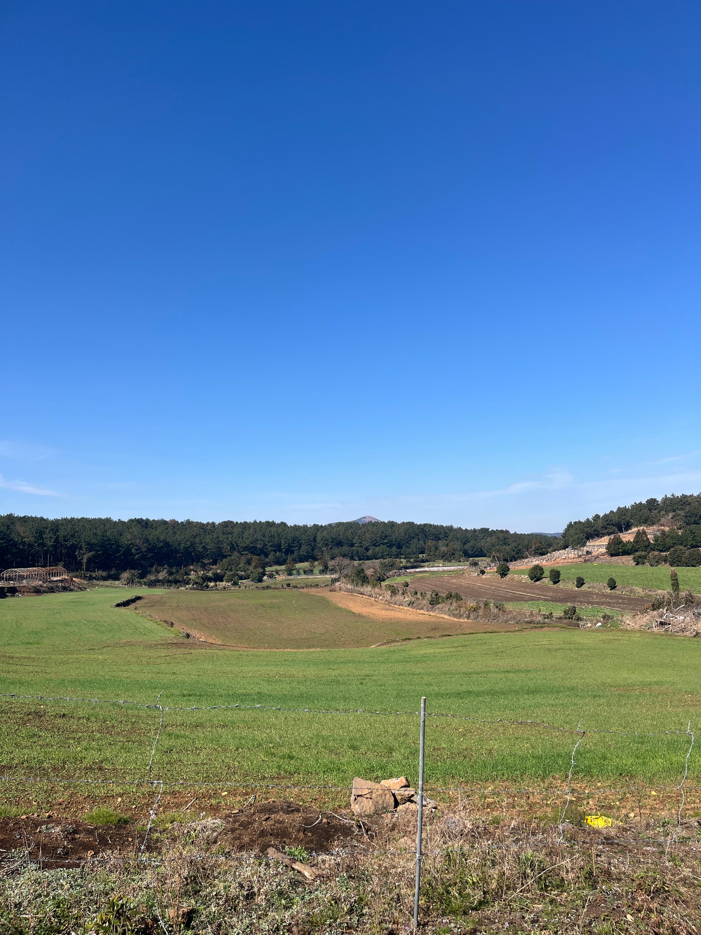
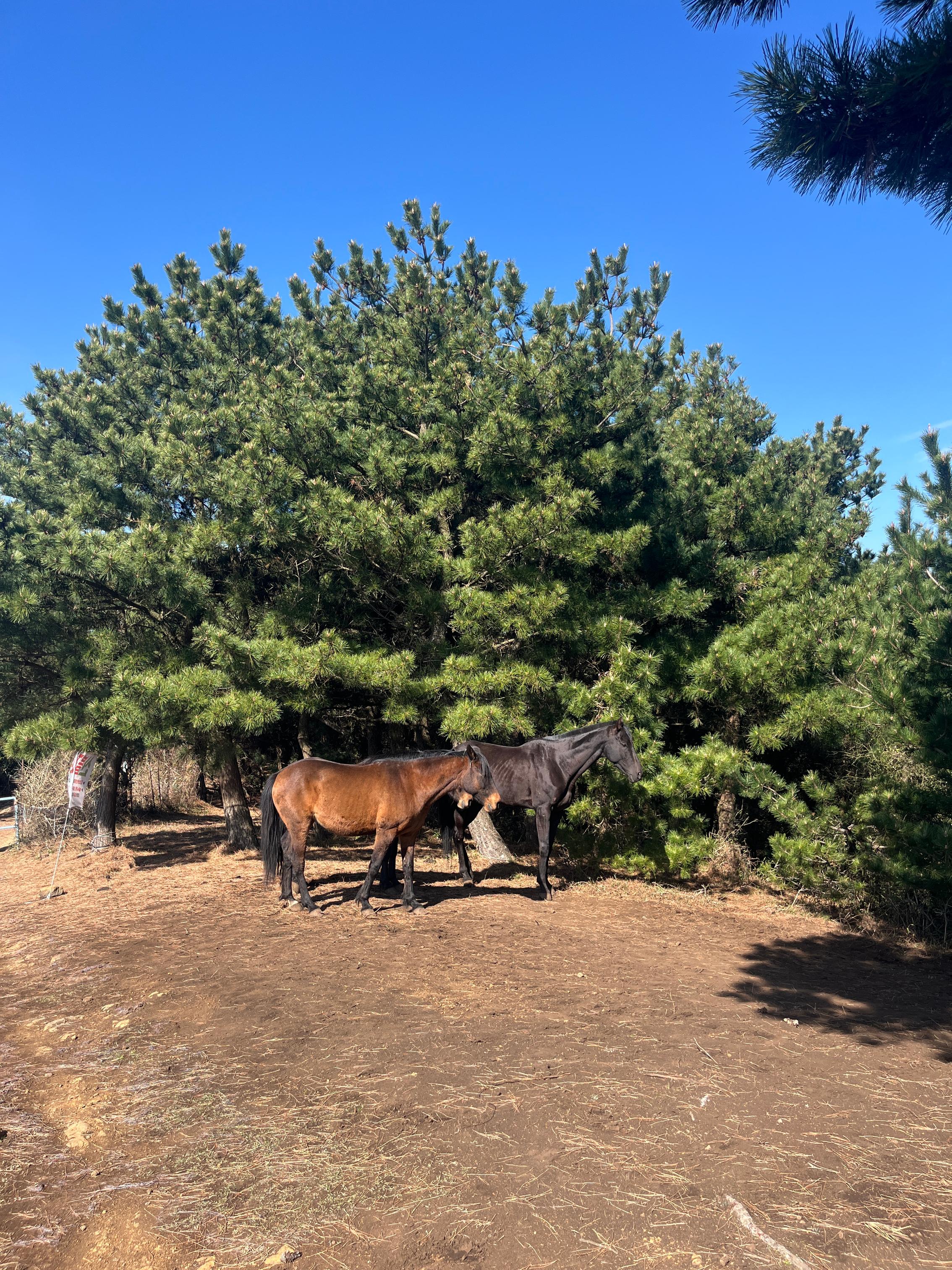
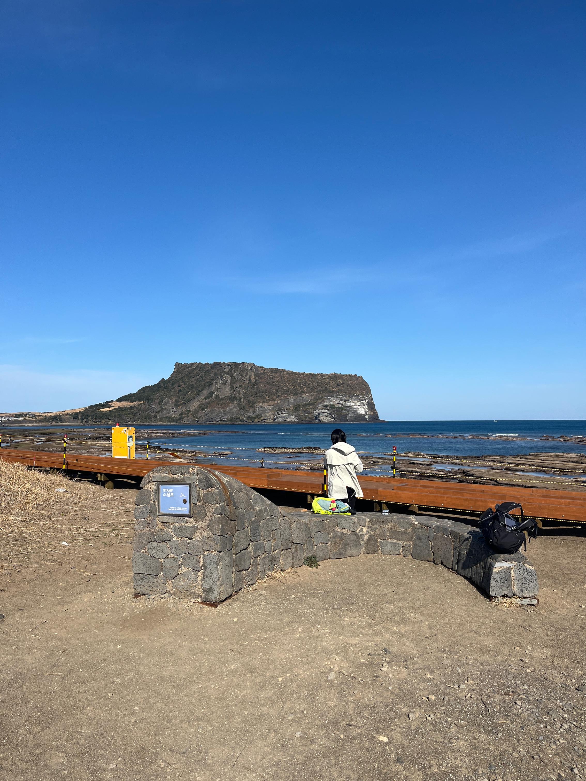
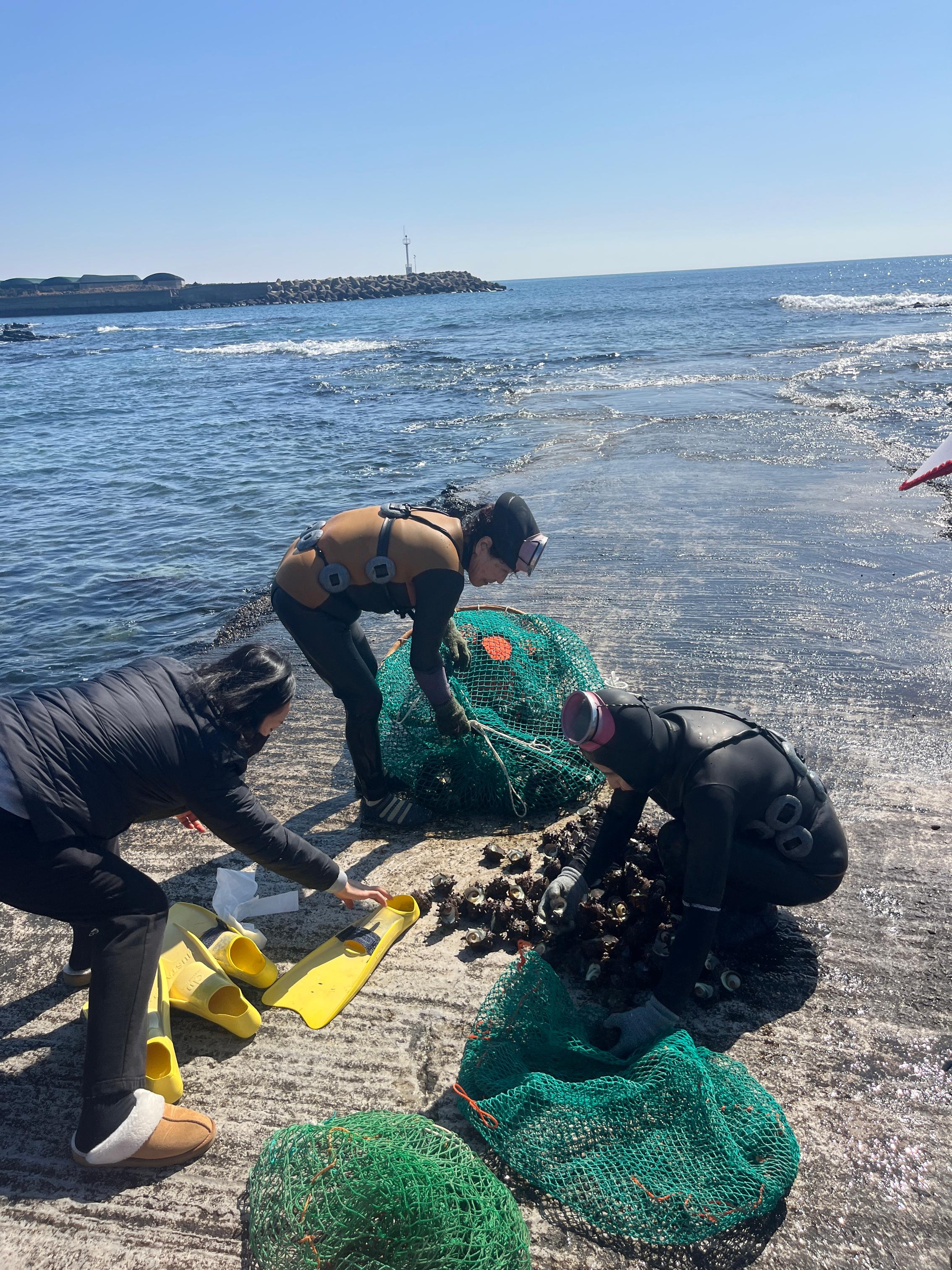
Trail 1 is 15.1 km long, and it starts right away with a mountain climb, truly exhausting. But once I climbed up a ridge and saw a herd of horses, it left a deep impression. After that, at the highest point, the view over Udo and Seongsan Ilchulbong was beautiful. Then it was downhill the whole way into town. For lunch I had their local all-you-can-eat buffet, Jongdal Miso. The locals I met while walking were super friendly and even taught me how to serve myself, basically everything you see is fair game, and you can go back as many times as you want. I really think it’s a must, there’s a huge variety and it’s great value. The price is 10,000 Korean won.
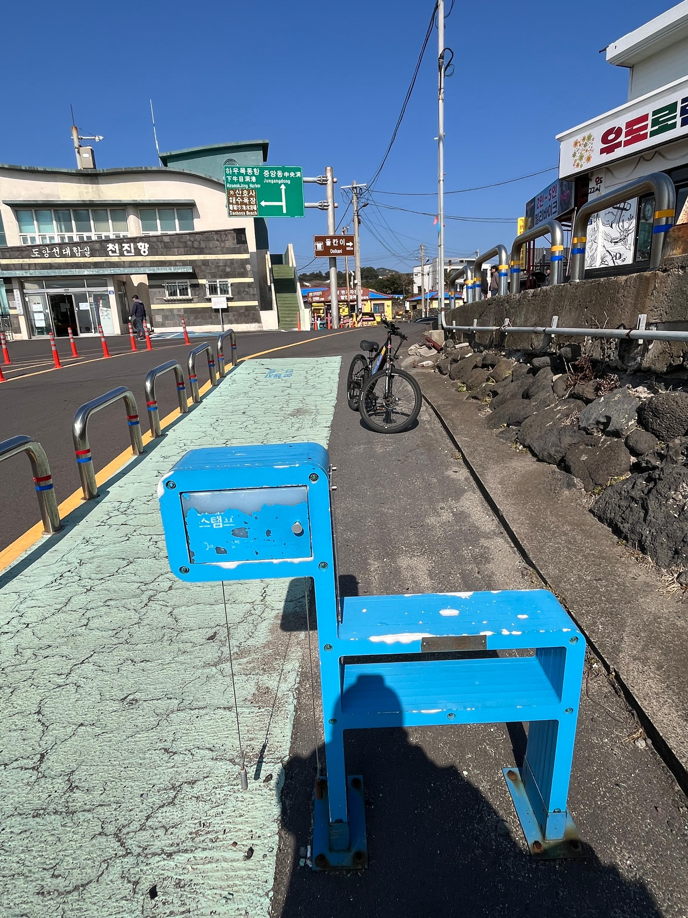
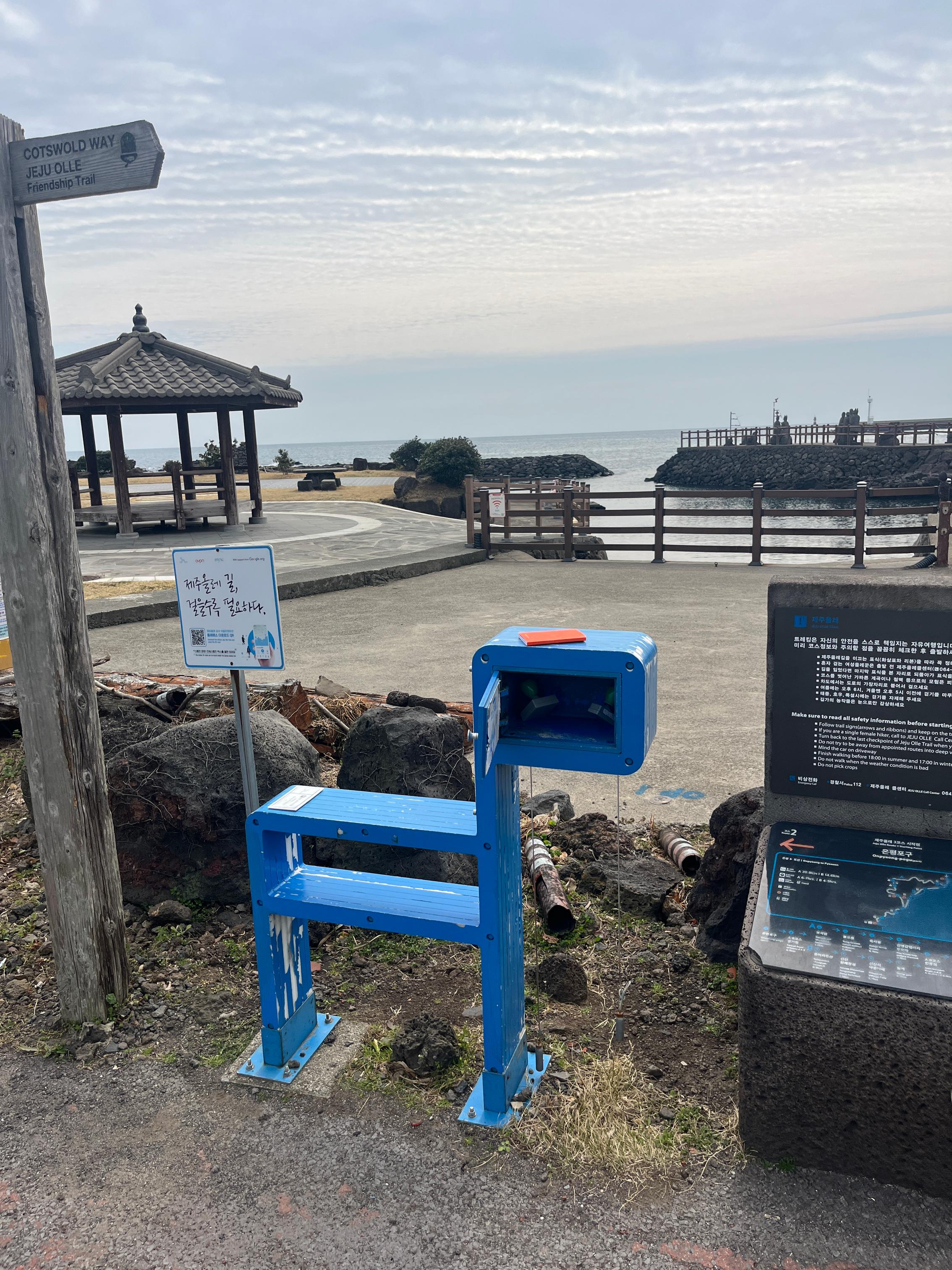
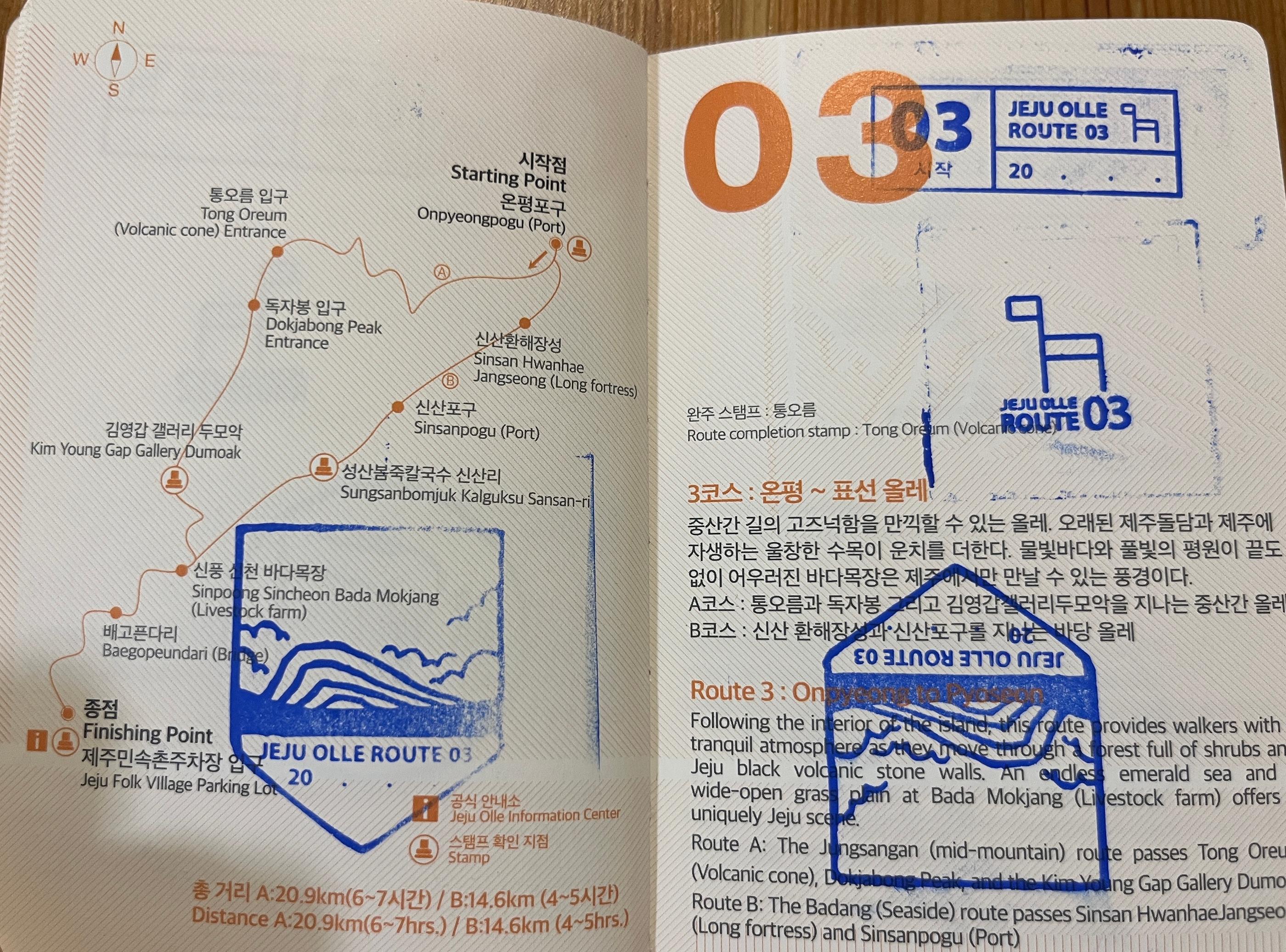
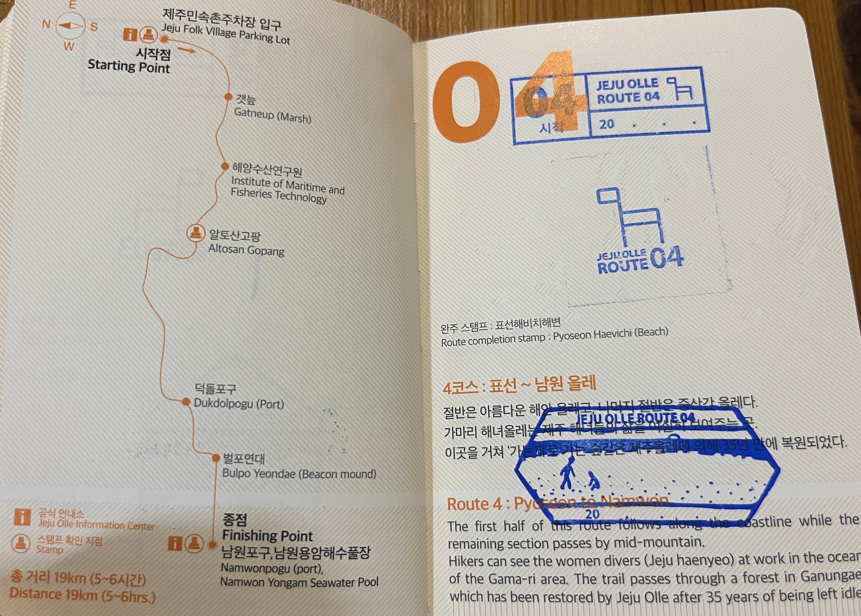
For Trail 1, the start stamp is at the visitor center. The mid-course stamp is outside a restaurant called Cotton Restaurant Rest Area, Mokhwa Sikdang Rest Area. The finish stamp is at Gwangchigi Beach, Gwangchigihaebyeon. This is also the start stamp for Trail 2. Then Trail 2 connects to Trail 3, Trail 3 to Trail 4, and so on, it’s the same concept. The finish stamp becomes the next trail’s start stamp, so I think it’s easiest to just follow the sequence. There’s no need to stress about which trail to choose.
Trail 1-1 is 13.2 km long. I took a ferry to Udo and enjoyed the island. Thinking back, the last time I came was two years ago, and I toured Udo by bus, then spent the afternoon at a cafe with an ocean view, sipping coffee and eating peanut ice cream. This time I sat in a supermarket, quickly eating instant noodles with bottled water, and rushed to finish all three stamps. Both the start and finish stamps are at the pier, and the mid-course stamp is at Hagodong Beach.
Trail 2 is 14.8 km long. Once you climb to the summit, you get a 360-degree view and the scenery is stunning. As you gain elevation, you’ll notice the landscape opening up more and more. When you reach the top of Daesusan, the unobstructed 360-degree panorama really moves you, at least it moved me, maybe because I was exhausted from the climb. The mid-course stamp is at the summit of Daesusan, and the finish stamp is at the small fishing harbor of Onpyeong, Onpyeong Pogu (the start stamp for Trail 3).
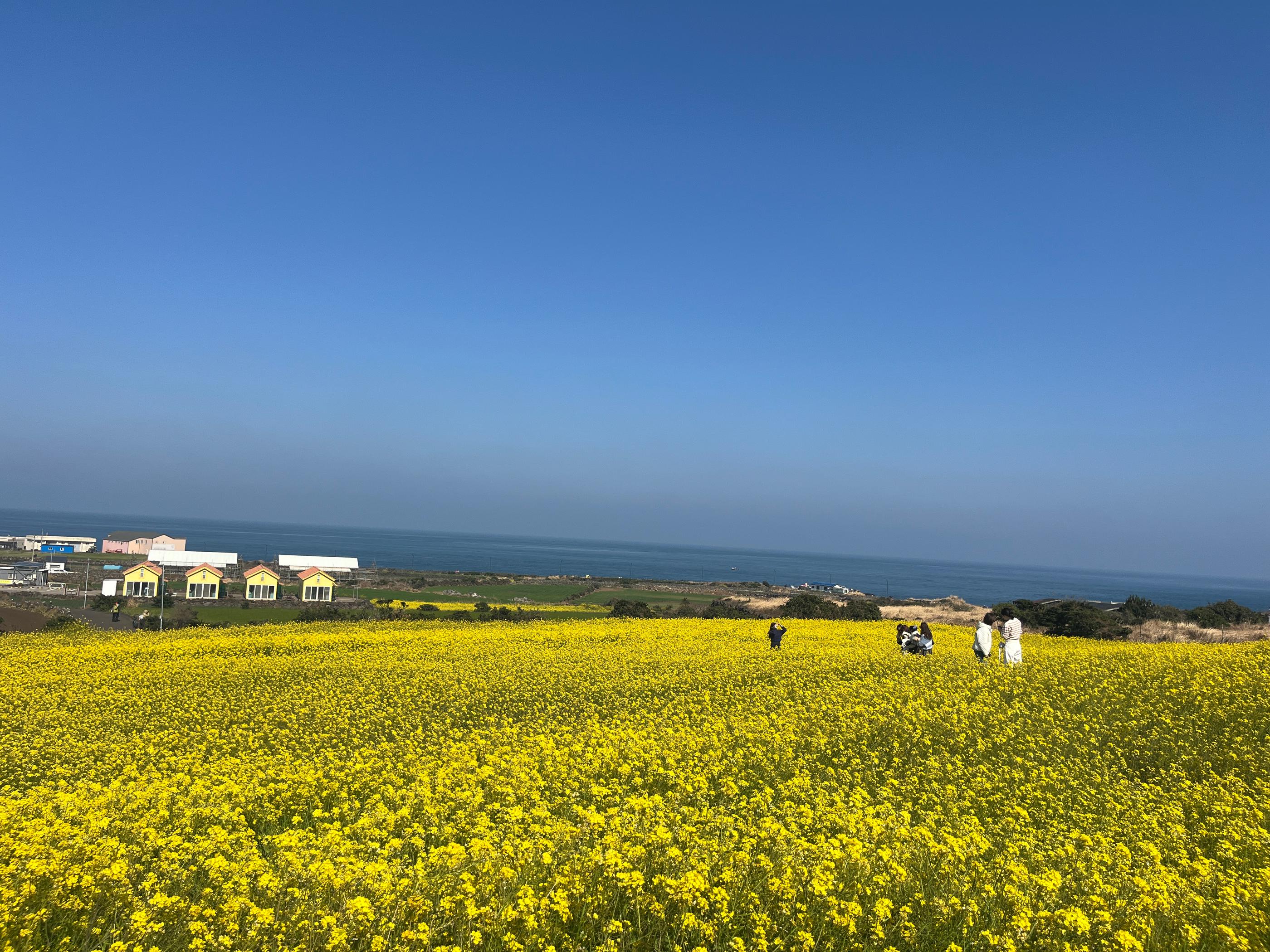
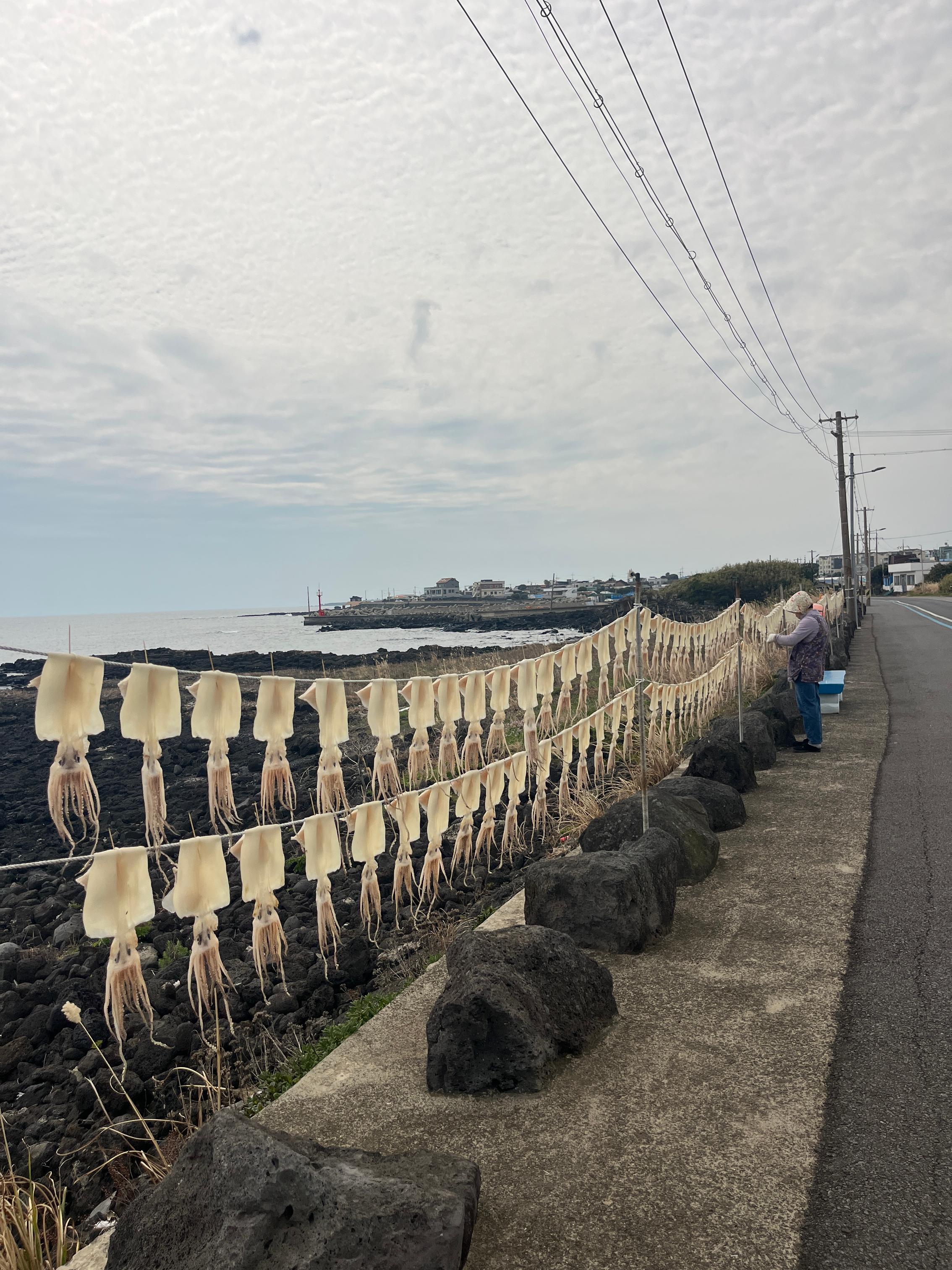
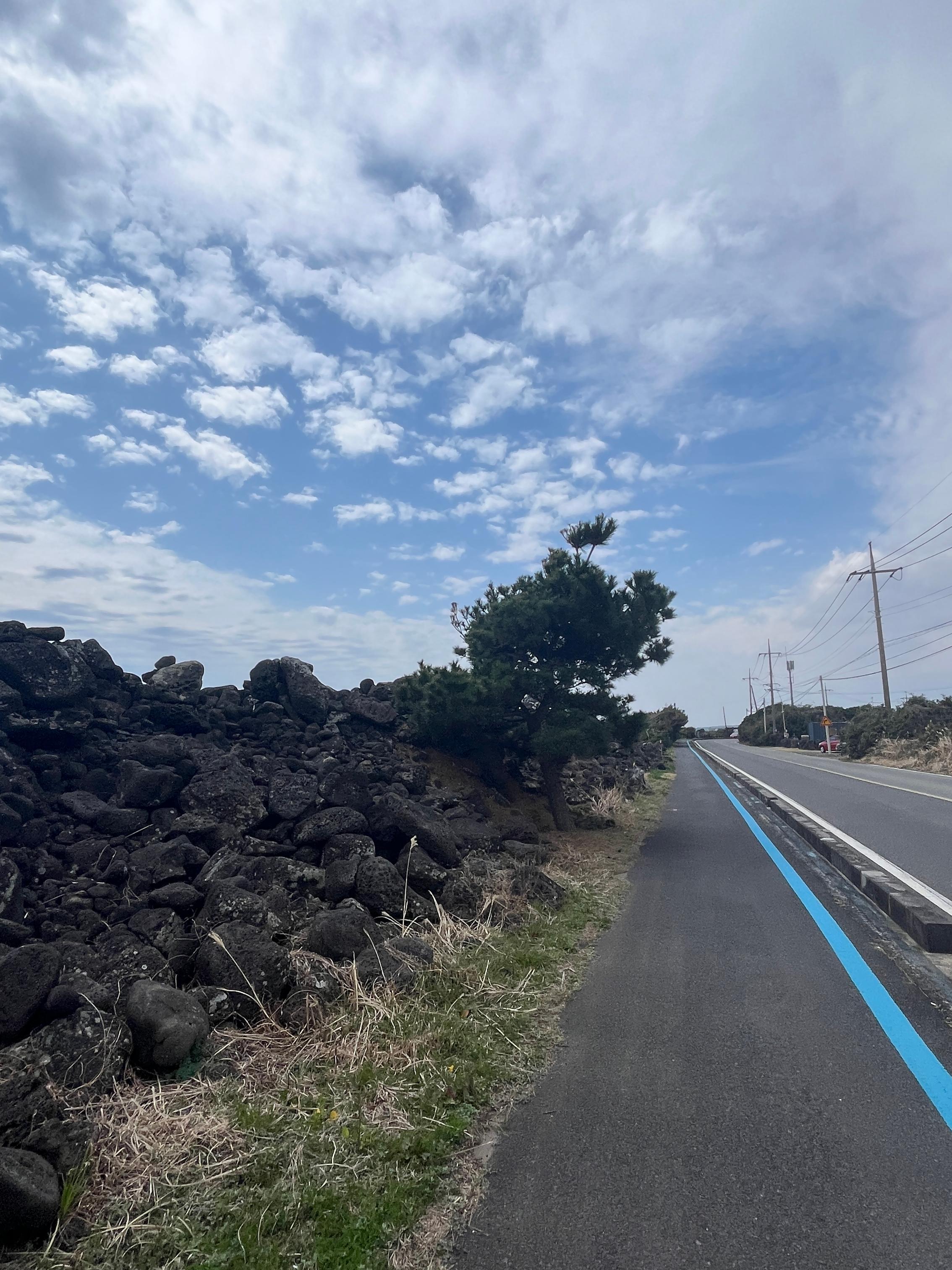
Trail 3 has 3A and 3B options. I chose the 3B route, which has more coastline, and it’s 14.6 km long. Walking along the shore, you pass many fishing villages and Gojik Coastal Fortress Wall. You also pass a place called Sincheon Ranch, Sincheon Mokjang. It’s unbelievably beautiful, a seaside ranch, I stayed here for a long time.
The mid-course stamp for Trail 3 is outside Sinsanri Maeul cafe, and the finish stamp is outside Jeju Folk Village. I stayed one night in this town and found a BBQ place where you can dine solo at your own table. It was super local, packed with people, and the food was delicious, the grilled pork skin was bouncy and chewy. If you’re alone, you have to order at least two portions of meat, and you can mix items. I ordered samgyeopsal for 11,000 Korean won plus pork skin for 9,000 Korean won, which was really good value, and they also included a bowl of doenjang jjigae. After hiking all day, this dinner was perfect.
Trail 4 is 19 km long. The scenery changes less, and for a lot of the time you’ll be walking through small town lanes. Later you’ll also walk along the sea, which is still beautiful. Maybe it’s the simple, pure street views and ocean views that let you calm down and really talk to yourself, filtering out the noise in your head. I think that’s the best moment. The mid-course stamp for Trail 4 is on the roadside one street above Fantastic Burger, this burger place is very famous. The finish stamp is at Namwon Fishing Port, right outside the Olle visitor center.
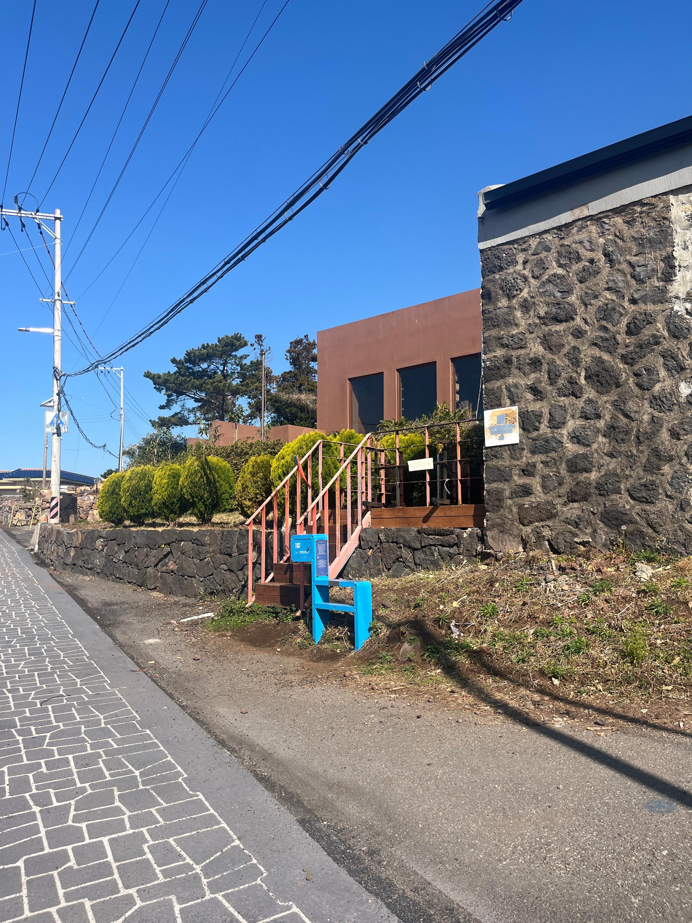
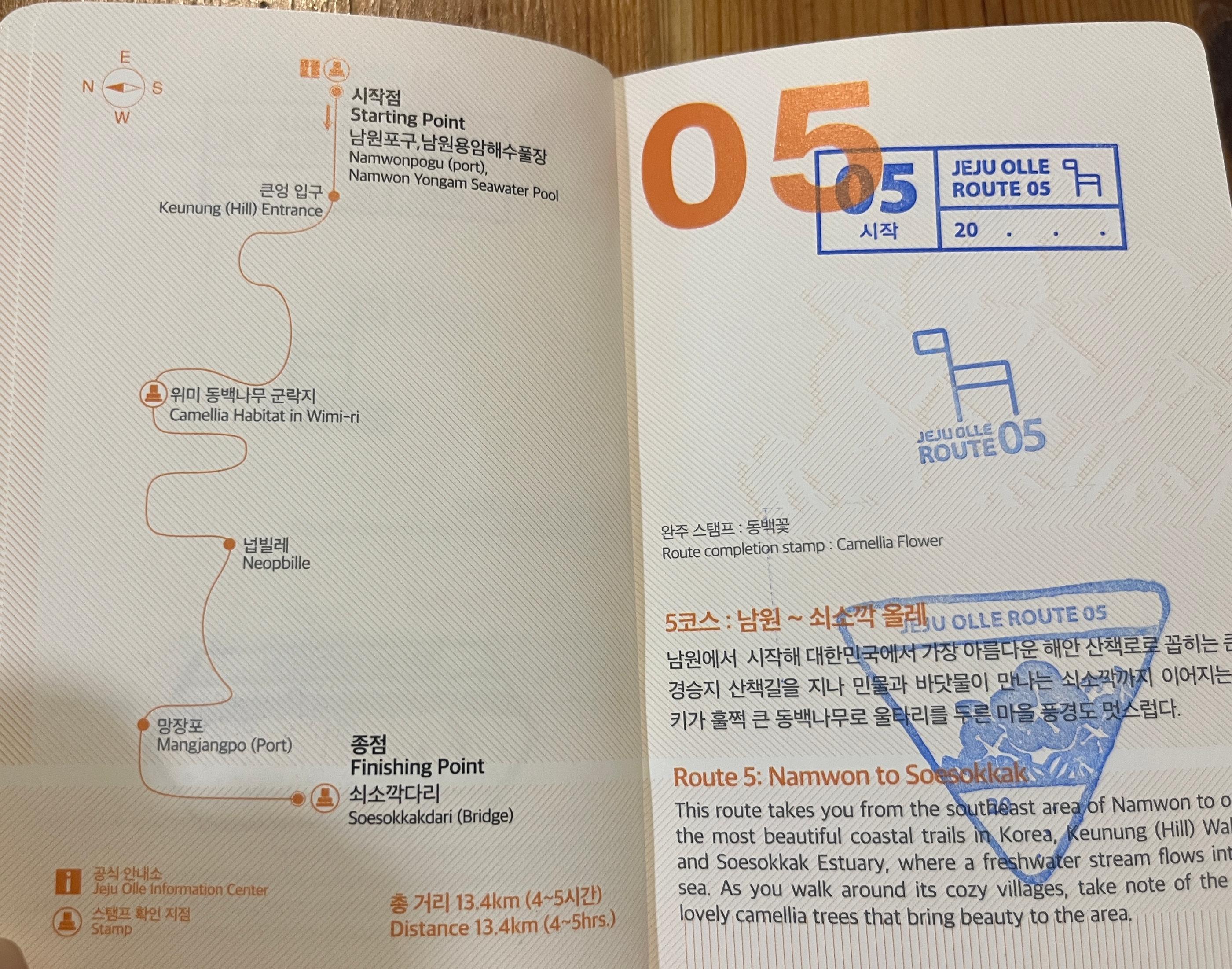
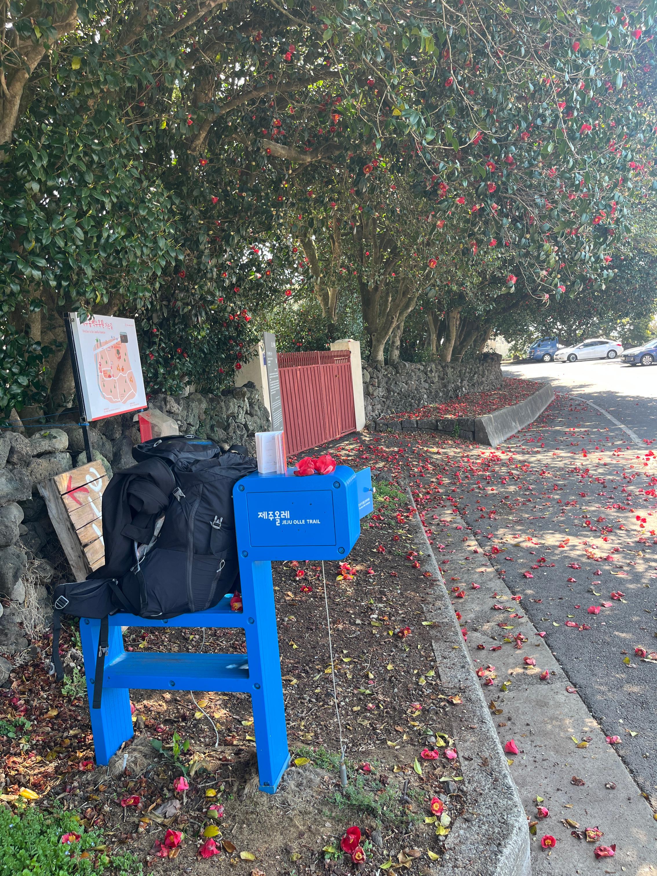
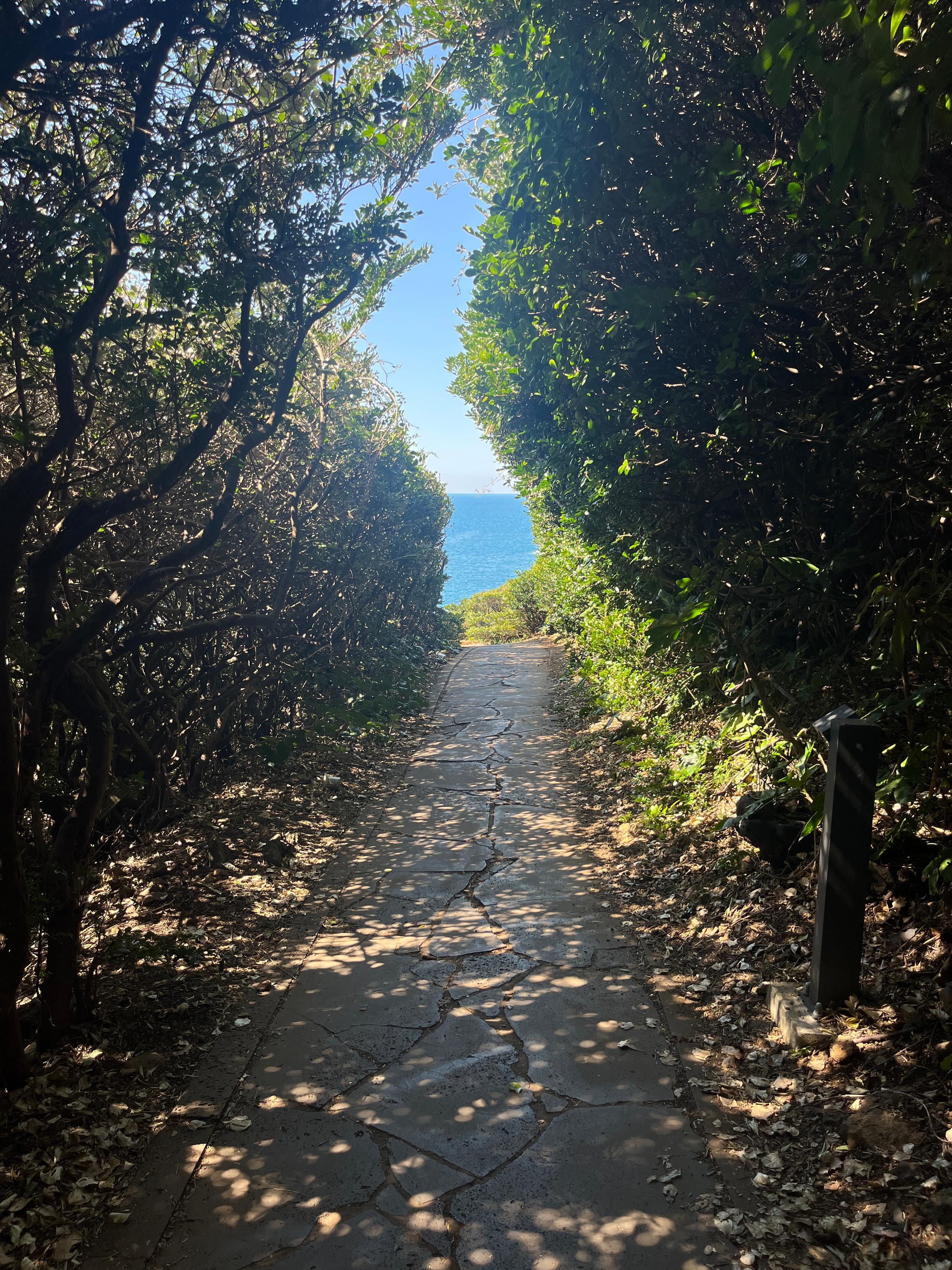
Trail 5 doesn’t seem to get discussed much. It’s 13.4 km long, and I think it’s not too long. The whole trail starts from Namwon Fishing Port, then after passing through a dense, shaded forest path, it suddenly turns into a coastal cliff trail. And the cliff “trail” isn’t a normal path, it follows the natural terrain, so it doesn’t even feel like a proper road. That actually makes it more fun. The scenery changes a lot, and the coastal views are gorgeous. The mid-course stamp is outside Wimi Camellia community, Wimi-ri Dongbaeknamu Gunrak. There are tons of camellias here, and many people come specifically to see the flowers. The finish stamp is by the bridge at Soesokkak.
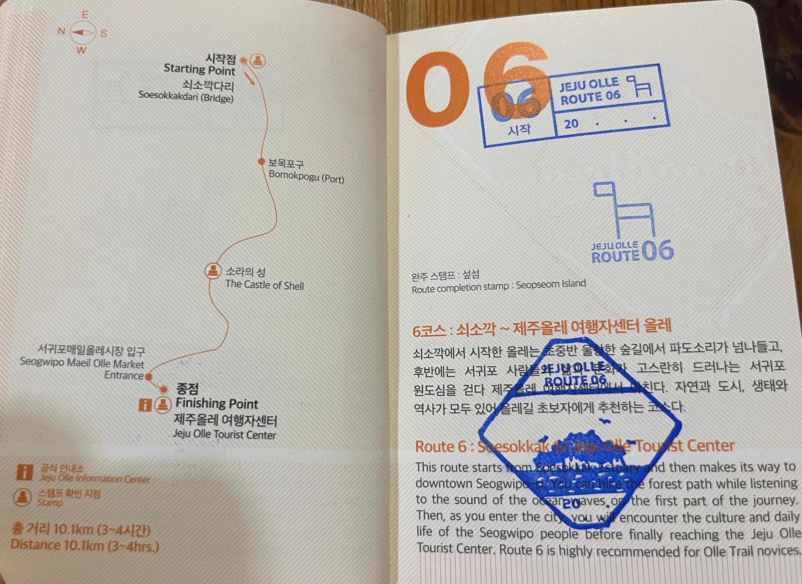
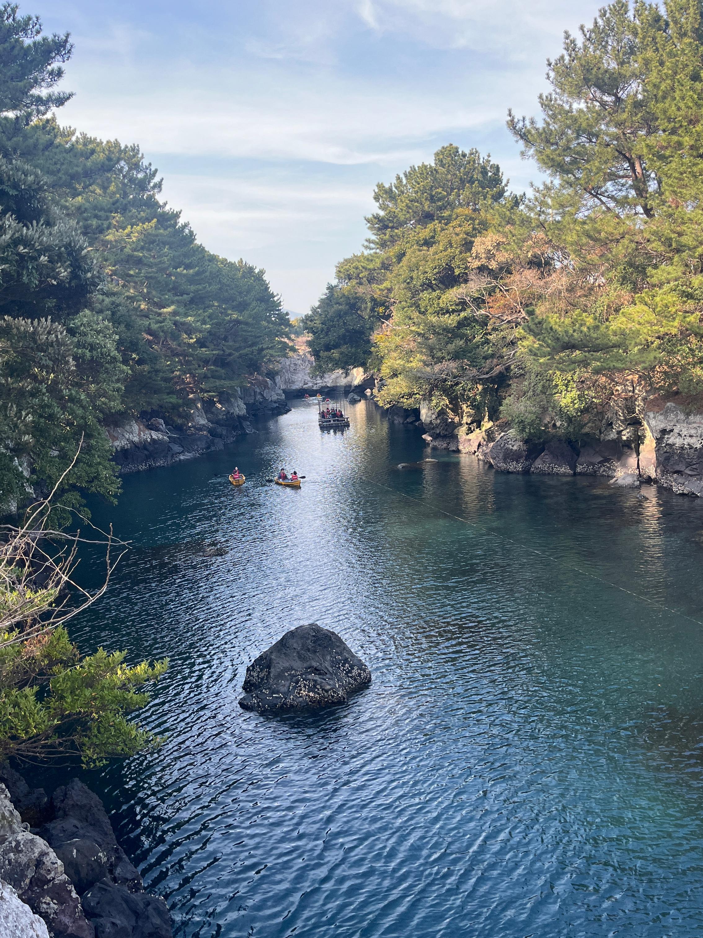
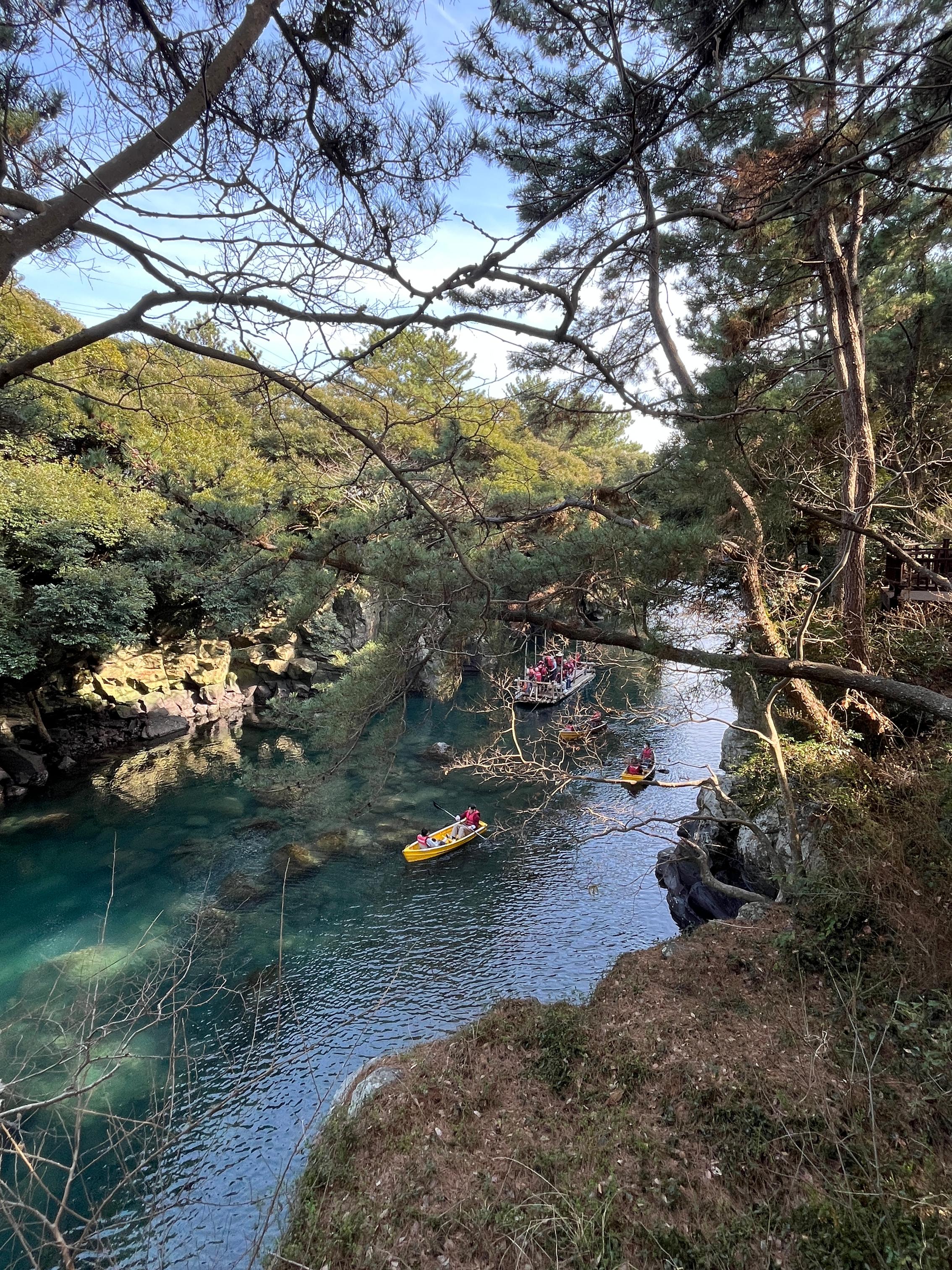
Trail 6 is 10.1 km long, and the highlight is Soesokkak, it’s truly beautiful. I recommend taking a small boat to enjoy the natural valley scenery, or you can ride their rope-pulled ferry, which is pretty unique. But if you have company, renting a little boat is really nice. The finish pavilion for Trail 6 is right outside the Jeju Olle visitor center.
That day I hiked Trails 5 and 6 together, so by the time I got to the visitor center it was already around 7 or 8 pm. I checked in first, then came back the next morning to apply for the certification.
When I went to get certified at the visitor center the next day, I saw many couples in their 60s and 70s coming to do the certification together. There were several pairs, and they had all completed the full 437 km, it was seriously impressive. The ceremony also felt very meaningful, staff say a short congratulatory message and help the finishers take photos.
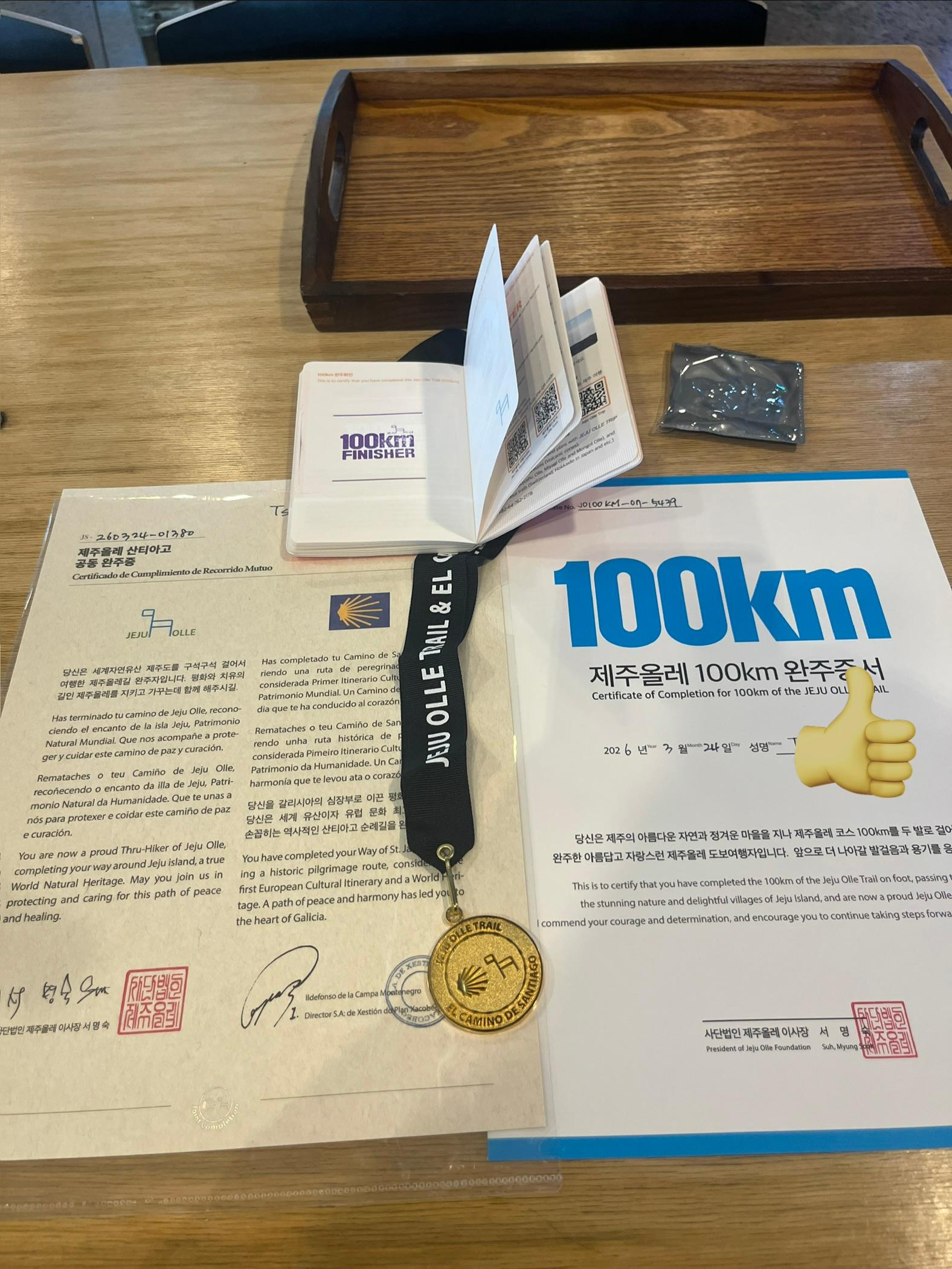

Extra note: The Camino de Santiago& Jeju Olle dual certification comes with a medal, while the Camino de Santiago& Kumano Kodo dual certification only comes with a small pin.
#JejuOlle
#Dual-certification medal


