Seoul Subway Map for Travelers: MRT, Metro, and Train Station Basics
A practical Creatrip-style look at Seoul’s official subway maps, the redesigned 2026 network map, airport trains, fares, and station maps worth using before you ride.

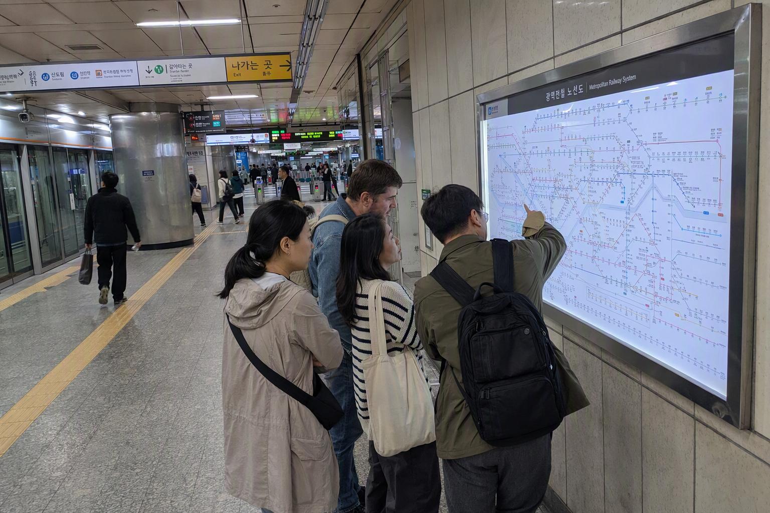
In Korea, people rarely call it the MRT. On signs and official websites, you’ll usually see subway, metro, train, or Seoul Metropolitan Subway. But if you typed Seoul MRT map, Seoul subway station map, or Seoul train station into your search bar, you’re in the right neighborhood: Seoul’s rail system works very much like the big urban metro networks travelers know from Singapore, Taipei, Tokyo, and Hong Kong — just wider, denser, and spread far beyond the city limits.
By 2026, the broader Seoul metropolitan rail network is around 24 lines, more than 650 stations, and about 1,300 km of track, run by several operators including Seoul Metro, Korail, AREX, Incheon Transit, NeoTrans, and private Line 9 operators. That’s why a single subway map can feel like a bowl of noodles at first glance. The good news is that Seoul has been actively redesigning its maps and station information to make them easier to read, especially for international visitors.

The Seoul MRT map you probably want is the Seoul subway map
For travel planning, use the terms Seoul subway map, Seoul metro map, or Seoul Metropolitan Subway map when searching official sources. MRT is understandable internationally, but it isn’t the wording most Korean transit sites use.
The most useful official options are:
| What you need | Best map to use | Why it helps |
|---|---|---|
| A full network overview | Seoul Metro’s official English subway map | Clean route planning, transfer stations, line colors |
| A quick route check | Seoul Metro Cyber Station or the Korea Tourism Organization’s ODsay-powered metro map | Interactive routing across Seoul and other Korean cities |
| Sightseeing around neighborhoods | Seoul City or Visit Seoul English tourist map | Subway lines plus attractions, markets, museums, cafes, trails, and palace areas |
| Exact station exits and facilities | Seoul Metro station usage maps | Toilets, elevators, escalators, emergency routes, and exit layout |
| Airport into Seoul | AREX official route and fare information | Express and All-Stop trains have different fares and ticketing styles |
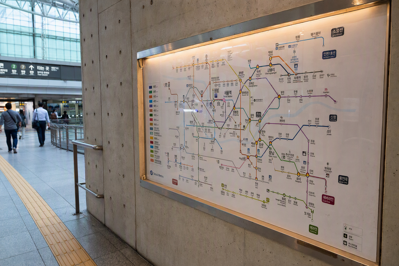
Seoul Metro distributes official subway maps in Korean, English, Simplified Chinese, and Japanese. The public map package is updated annually; the version registered on 2025-12-08 has its next scheduled update listed for 2026-12-08. Since openings and operating details can shift, it’s still worth checking the latest official Seoul Metro, Seoul City, or Visit Seoul page before relying on an old screenshot.
For sightseeing, the Seoul tourist map is lovely in a different way. The 2026 English Seoul tourist map was registered on 2026-03-11 as part of the city’s annual brochure set, and it layers transit with places travelers actually look for: cafes, markets, museums, hiking routes, heritage sites, and neighborhood points of interest. The subway map gets you between stations; the tourist map helps you decide what to do once you come above ground.
Why the newest Seoul subway map looks different
Seoul’s redesigned subway map is a big deal locally because it changed a map style that had been familiar for decades. The newer design uses an octolinear system, which means lines are drawn horizontally, vertically, or at 45-degree angles. It’s a schematic map, not a literal street map, so the spacing between stations is about readability rather than real-world distance.
That trade-off is exactly what makes it easier to use underground. The city’s redesign includes clearer transfer station symbols, adjusted colors and patterns for travelers with color-vision deficiencies, and geographic anchors such as the Hangang River, the Yellow Sea, and Incheon Airport. Seoul also added pictograms for major attractions, so the map feels less like a technical diagram and more like something made for people moving through a real city.
Seoul reports that eye-tracking tests found station-finding time dropped by up to about 55%, while finding transfer stations became about 69% faster. Even without knowing the design theory, you can feel the intention: less clutter, clearer transfers, and fewer moments of staring at a map wondering where the line went.
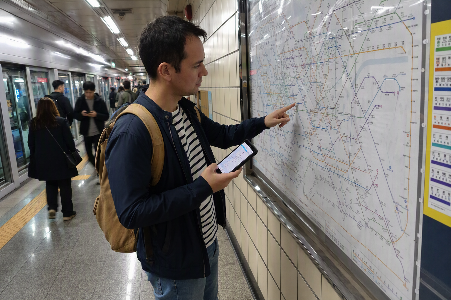
How to read the Seoul subway map without overthinking it
Seoul’s system is color-coded, and station signage is generally consistent in Korean, English, and Chinese. Official map files are also available in Japanese, which is helpful if you’re traveling with friends or family who prefer different language references.
A few map habits make the ride much smoother:
Follow the line color first, then the direction
On a large network, the station name alone isn’t enough. Look at the line color, then check the direction of travel. The redesigned map makes line paths easier to trace, but platforms still depend on direction. At transfer stations, give yourself a little extra mental space — some transfers are quick, while others involve a real underground walk.
Treat the subway map as a train diagram, not a walking map
Because the official map is schematic, two stations that look close together may not be equally easy to walk between above ground. Use the subway map for rail movement and the tourist map for neighborhood wandering. This matters especially in central Seoul, where areas like Jongno, Myeongdong, Gwanghwamun, and Dongdaemun are packed tightly with stations and attractions.
Open a station map when exits matter
Seoul Metro provides station-level usage maps for the stations it operates, including Lines 1–8 and Line 9 phases 2–3. These maps show practical details such as toilets, elevators, escalators, emergency evacuation routes, and station exits. One important change: first and last train timetables were removed from these station usage maps as of 2025-03-10 because schedules change frequently. For late-night rides, check the latest route planner or official station information instead of trusting an old image.

Fare basics: the part where special lines can surprise you
As of 2025-06-28, the basic metropolitan subway fare for adults using a transportation card is ₩1,550. A one-time ticket is ₩1,650 plus a ₩500 refundable deposit. Distance surcharges apply: ₩100 per 5 km from 10 km to 50 km, then ₩100 per 8 km beyond 50 km. There is also a 20% early-morning discount before 06:30.
Fares can change, and some lines price themselves differently, so always verify the latest fare before budgeting tightly. For most short sightseeing trips inside Seoul, the regular subway fare is simple enough. The surprises usually come from airport services, Shinbundang Line, and GTX-A.
AREX: airport trains are not all the same
AREX has two different airport-city services, and they look deceptively similar on a map.
The Express train runs non-stop between Incheon Airport and Seoul Station. It takes about 43 minutes from Terminal 1 to Seoul Station and about 51 minutes from Terminal 2 to Seoul Station, with reserved-seat tickets priced around ₩13,000 for adults and ₩9,500 for children.
The All-Stop train behaves more like a regular metro service. It accepts T-money, takes roughly 59–66 minutes between Seoul Station and Incheon Airport depending on terminal and service details, and costs roughly ₩4,750–₩5,350.
The choice is less about which one is better and more about what kind of arrival day you’re having. If you want a reserved seat and the cleanest airport-to-Seoul Station ride, the Express is appealing. If price matters more or you’re connecting along the way, the All-Stop train is easier on the wallet.

Shinbundang Line: fast, useful, and more expensive
The Shinbundang Line runs along the Sinsa–Gangnam–Jeongja–Gwanggyo corridor and is priced separately from the regular subway structure. The fare combines the metropolitan basic fare, distance surcharge, and an additional Shinbundang surcharge.
Adult section surcharges include ₩700 for Sinsa–Gangnam only, ₩1,000 for Gangnam–Jeongja or Jeongja–Gwanggyo, ₩1,500–₩1,700 when combining two sections, and ₩2,200 when traveling across all three Shinbundang sections from Sinsa through Gangnam and Jeongja to Gwanggyo. These surcharges still apply when using the metropolitan integrated transfer system.
For travelers, Shinbundang is a classic Seoul trade-off: it can be quick and convenient, especially around the Gangnam axis, but it may cost more than expected if you assume every colored line charges the same basic fare.
GTX-A: don’t treat it like a normal subway line
GTX-A is a metropolitan express rail line with a separate fare system. Adult card fares combine a metropolitan base fare and a GTX-A separate base fare. The adult weekday combined base is listed as ₩3,200, while the weekend base is listed as ₩2,850. Distance surcharges are also different from the standard subway calculation.
Example adult weekday fares include ₩4,450 for Suseo–Dongtan, ₩4,450 for Unjeongjungang–Seoul Station, and ₩4,200 for KINTEX–Seoul Station. GTX-A can be cheaper than comparable high-speed options on some routes, but it is not priced like a normal subway ride.
The big 2026 change to watch is the GTX-A connection through Seoul, with official planning pointing to the Seoul Station–Suseo link and broader Paju Unjeong–Hwaseong Dongtan connection, while Samseong Station is listed for 2028. Because this is exactly the kind of route where dates and service patterns matter, check current operation status before building a tight airport, meeting, or intercity rail plan around it.
Seoul Station: more than just another dot on the map
Seoul Station is one of the easiest places for international travelers to recognize because it anchors the city-center end of AREX airport service. On a subway map, it may look like a simple transfer point. In reality, it’s the kind of station where exits, service type, luggage, and timing all matter.
If you’re arriving from Incheon Airport, double-check whether your ticket is for AREX Express or All-Stop. If you’re transferring onward, station usage maps can help you find elevators and exits, which is far more useful than zooming endlessly into a network map.
For future rail changes, keep an eye on official updates around Incheon-origin KTX service, which has been listed for a planned December 2026 opening. That won’t change a casual subway ride to Myeongdong, but it may matter for travelers connecting Seoul, Incheon, and other Korean regions by rail.

Tourist-friendly ways to use the subway map
The subway map is best when you pair it with one or two real travel anchors. A station name becomes much easier to remember when it’s tied to a palace gate, a stream walk, or the airport route you’ll actually use.
Gyeongbokgung Palace: exit choice matters
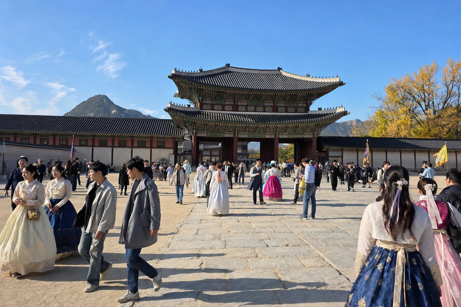
Gyeongbokgung Palace is one of the clearest examples of why station exits are worth checking. The palace is accessible from Line 3 Gyeongbokgung Station Exit 5, about 216 m away, and Line 5 Gwanghwamun Station Exit 2, about 471 m away.
As of 2025 information, Gyeongbokgung is closed every Tuesday, foreign adult admission is ₩3,000 for ages 19–64, and visitors in full hanbok can enter free. English guided tours are listed at 11:00, 13:30, and 15:30 except Tuesdays, with reservations required for groups of 10–30. Those details can change, so confirm the latest palace notice before centering a day around a tour.
The map lesson is simple: the nearest station is helpful, but the right exit is what makes the arrival feel easy.
Cheonggyecheon Stream: a central Seoul spine
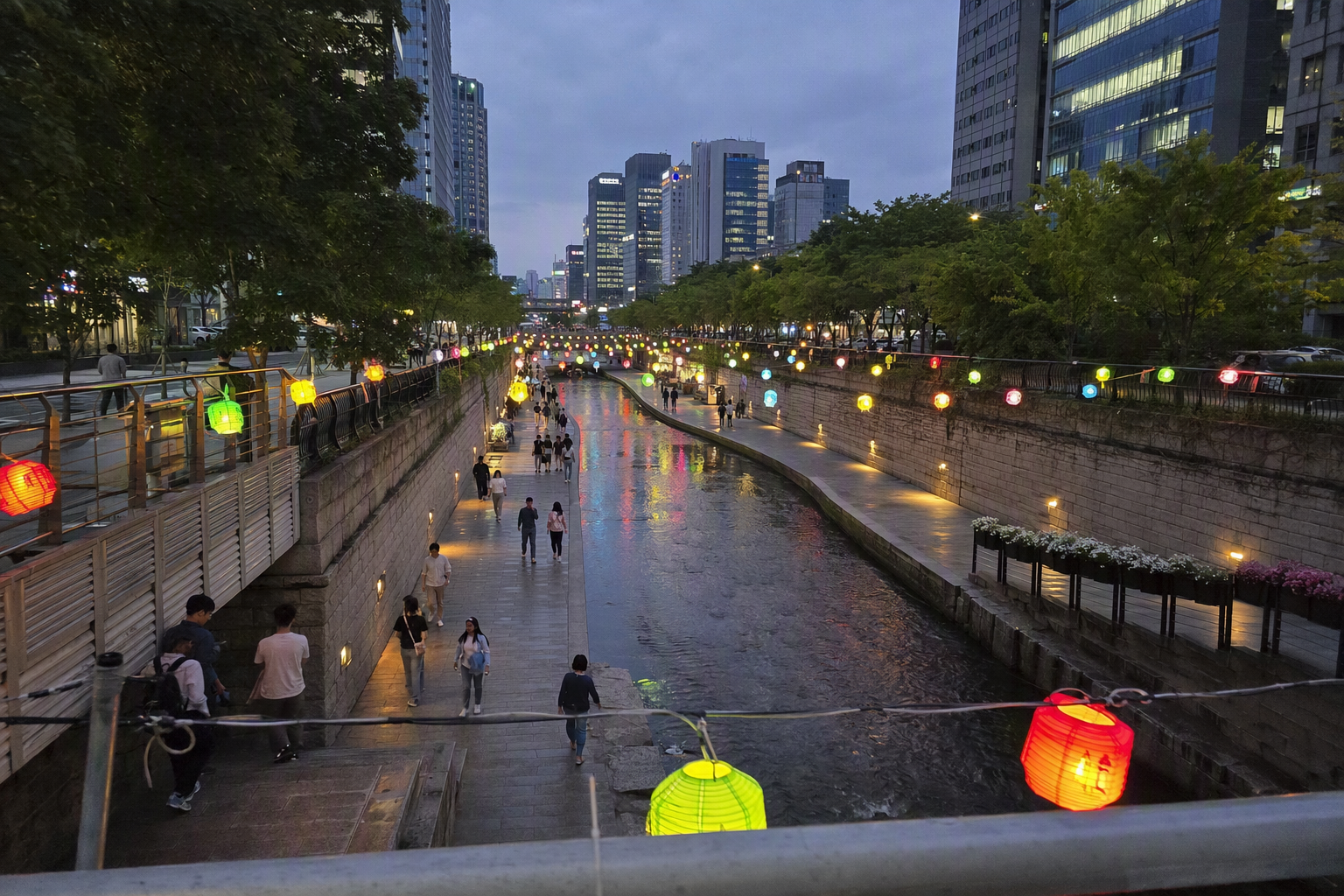
Cheonggyecheon is an 11 km restored stream running through central Seoul, starting at Cheonggye Plaza and passing under 22 bridges before reaching the Hangang River area. It is open 24 hours, though access may be restricted in rain.
For map planning, Cheonggyecheon is useful because it connects with many subway stations around Jongno, Euljiro, Dongdaemun, and nearby central districts. Official information lists connections to 11 subway stations, including City Hall, Jonggak, Jongno 3-ga, Jongno 5-ga, Dongdaemun, Dongmyo, Sinseol-dong, Eulji-ro 1-ga, Eulji-ro 3-ga, Eulji-ro 4-ga, Dongdaemun History and Culture Park, and Yongdu across Lines 1 and 2 and nearby connected lines.
Rather than treating it as one long walk, use the subway map to enter and exit wherever your day naturally bends. It’s especially handy when you want a low-pressure route through central Seoul without committing to one single neighborhood.
The 2026 network changes worth checking before you travel
Seoul’s rail map is not frozen. Around 2026, several changes and planned openings affect how current a saved map really is.
GTX-A is the headline for many commuters and longer-distance travelers because it reshapes fast movement across the metropolitan area. The Seoul Station–Suseo connection has been tied to 2026 planning, with Samseong Station listed later for 2028.
The Seohae Line’s Wonsi–Seohwaseong connection is listed with a target in the second half of 2026, creating a more direct link between Chungnam Hongseong and the Gyeonggi Goyang and Ilsan area. Incheon-origin KTX service is also listed with a planned December 2026 opening.
For a short Seoul sightseeing trip, these changes may not affect your palace-and-cafe day at all. For airport connections, outer-city stays, business travel, or day trips beyond central Seoul, they matter. A map saved six months ago might still look beautiful and be slightly wrong.
Common map mistakes we’d avoid
Downloading a random old map image
Seoul’s official map files are updated regularly, and the broader network keeps changing. Use Seoul Metro, Seoul City, Visit Seoul, or an official route planner when accuracy matters. Screenshots are convenient, but they age quickly around new lines and extensions.
Assuming every rail line charges the same fare
Regular subway rides are affordable, but AREX Express, Shinbundang, GTX-A, and some airport or light-rail services can use separate fare structures. The line may appear on the same map, but the fare rules may not be the same.
Ignoring station usage maps
A network map tells you which station to use. A station map tells you how to get out of it. With luggage, strollers, mobility needs, or a tight palace tour time, elevators and exits are not small details.
Trusting printed first and last train times too much
Seoul subway service generally runs roughly from 05:30 to midnight, but exact first and last trains vary by line, direction, day, and schedule changes. Since Seoul Metro removed first and last train timetables from station usage map files in 2025 due to frequent changes, use current official tools for late-night planning.
Our practical map setup for a smooth Seoul trip
Keep it light. One official English subway map gives you the full rail picture. One tourist map helps you connect stations to neighborhoods. An interactive planner handles live routing and late-night timing. Station usage maps are your backup when an exit, elevator, or transfer path matters.
That combination is much better than trying to memorize the whole network. Seoul’s subway map looks massive because Seoul is massive, but most visitor days follow a small set of lines, a few transfer stations, and one or two key hubs like Seoul Station. Once you stop treating the map as something to conquer and start using it as a flexible city tool, the system becomes one of the easiest parts of traveling in Korea.